Near-Real Time Verification and Validation of Autonomous Flight Operations
Information Technology and Software
Near-Real Time Verification and Validation of Autonomous Flight Operations (TOP2-320)
Universally applicable process for standardized data collection and auditing from autonomous systems
Overview
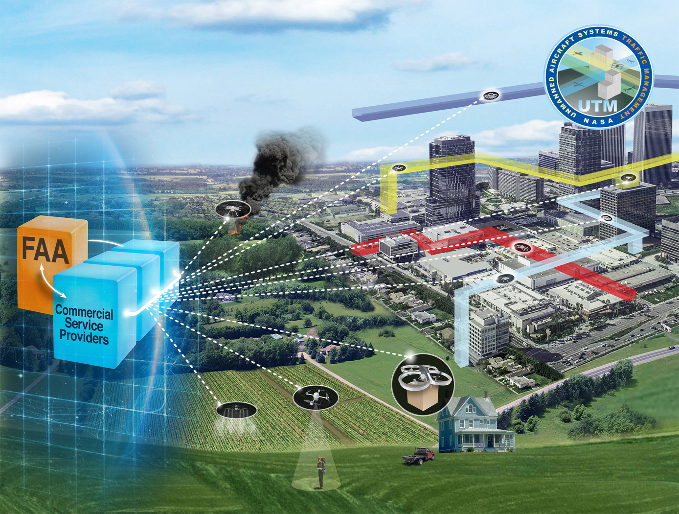
Autonomous systems necessitates timely technological audits to evaluate their performance, conformance, and compliance. For the aviation industry, such a need has already been recognized by the Federal Aviation Administration (FAA) for the vehicles, sensors, and systems participating in Extensible Traffic Management (xTM) systems. xTM systems include the Unmanned Aircraft Systems (UAS) Traffic Management (UTM), Advanced Air Mobility (AAM), and Upper-Class E Traffic Management, and are complementary to the Air Traffic Management (ATM) system. xTM systems enable new entrants such as UAS and AAM vehicles to safely participate in the national airspace. To facilitate timely technological audits of the xTM participants, NASA Ames developed a novel technology that provides near-real-time verification and validation of autonomous flight operations of an individual vehicle or numerous diverse vehicles being managed by the xTM systems.
The Technology
NASA's Extensible Traffic Management (xTM) system allows for distributed management of the airspace where disparate entities collaborate to maintain a safe and accessible environment. This digital ecosystem relies on a common data generation and transfer framework enabled by well-defined data collection requirements, algorithms, protocols, and Application Programming Interfaces (APIs). The key components in this new paradigm are:
Data Standardization: Defines the list of data attributes/variables that are required to inform and safely perform the intended missions and operations.
Automated Real Time And/or Post-Flight Data Verification Process: Verifies system criteria, specifications, and data quality requirements using predefined, rule-based, or human-in-the-loop verification.
Autonomous Evolving Real Time And/or Post-Flight Data Validation Process: Validates data integrity, quantity, and quality for audit, oversight, and optimization.
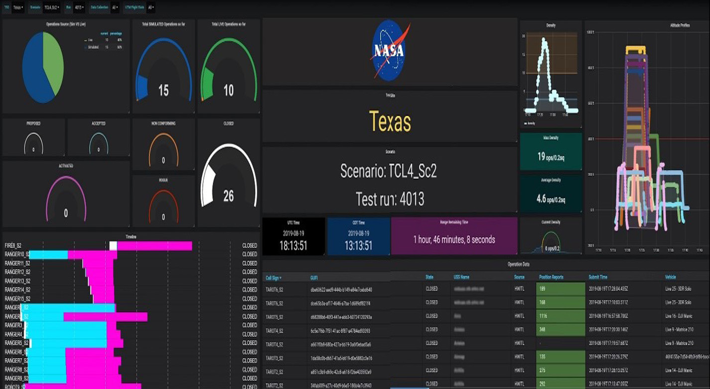
The verification and validation process determines whether an operation’s performance, conformance, and compliance are within known variation. The technology can verify thousands of flight operations in near-real time or post flight in the span of a few minutes, depending on networking and computing capacity. In contrast, manual processing would have required hours, if not days, for a team of 2-3 experts to review an individual flight.


Benefits
- Universal Applicability: A modular process enables a standardized, digital, data driven audit and oversight from automated or autonomous systems.
- Successful Flight Testing: Functions and features of this process were successfully developed, and flight tested by NASA Ames Research Center using thousands of live and simulated small UAS operations.
- Total Data Verification and Validation: This process allows for total data verification and validation as opposed to sample data testing, enabling accurate and holistic reporting.
- Fraud Detection: This process enables automated and/or human-in-the-loop detection and prevention of system fraud, wastage, or abuse such as identification of unnecessary reservation of excess airspace for UTM flight operations, etc.
- Platform Agnostic: Applicable to all types of UAS and AAM platforms, autonomous systems, their Ground Control Systems, sensors, and other data or service providers (e.g., weather, surveillance, etc.).
- Geographic Independence: Allows for applications independent of geographical location and altitude.
- Enhanced Capabilities: Allows the integration of additional visualization tools and machine learning processes for assessing risk, performing data analytics, data visualization, and developing insights.
Applications
- UAS industry
- UTM service suppliers
- Autonomous cars and trucks
- Autonomous ships and submarines
- Autonomous robots
- Autonomous manufacturing facility
- Large fleets of autonomous vehicles
- Automotive industry
- Aviation industry
- Technology industry
- Air and space traffic management systems
- Wildland Fire Management
- Internet-of-Things (IoT)
- Edge computing
- Space systems (including systems for transportation, communication, sensing, navigation and timing, manipulation, resource utilization and information and data processing)
Technology Details
Information Technology and Software
TOP2-320
ARC-18609-1
https://ntrs.nasa.gov/search?q=UAS%20Traffic%20Management
https://nari.arc.nasa.gov/events/utm2021tim/
|
Tags:
|
|
|
Related Links:
|
Similar Results

Unmanned Aerial Systems (UAS) Traffic Management
NASA Ames has developed an Autonomous Situational Awareness Platform system for a UAS (ASAP-U), a traffic management system to incorporate Unmanned Aerial Systems (UASs) into the National Airspace System. The Autonomous Situational Awareness Platform (ASAP) is a system that combines existing navigation technology (both aviation and maritime) with new procedures to safely integrate Unmanned Aerial Systems (UASs) with other airspace vehicles. It uses a module called ASAP-U, which includes a transmitter, receivers, and various links to other UAS systems. The module collects global positioning system GPS coordinates and time from a satellite antenna, and this data is fed to the UAS's flight management system for navigation. The ASAP-U module autonomously and continuously sends UAS information via a radio frequency (RF) antenna using Self-Organized Time Division Multiple Access (SOTDMA) to prevent signal overlap. It also receives ASAP data from other aircraft. In case of transmission overload, priority is given to closer aircraft. Additionally, the module can receive weather data, navigational aid data, terrain data, and updates to the UAS flight plan. The collected data is relayed to the flight management system, which includes various databases and a navigation computer to calculate necessary flight plan modifications based on regulations, right-of-way rules, terrain, and geofencing. Conflicts are checked against databases, and if none are found, the flight plan is implemented. If conflicts arise, modifications can be made. The ASAP-U module continuously receives and transmits data, including UAS data and data from other aircraft, to detect conflicts with other aircraft, terrain, weather, and geofencing. Based on this information, the flight management system determines the need for course adjustments and the flight control system executes them for a safe flight route.

Vision-based Approach and Landing System (VALS)
The novel Vision-based Approach and Landing System (VALS) provides Advanced Air Mobility (AAM) aircraft with an Alternative Position, Navigation, and Timing (APNT) solution for approach and landing without relying on GPS. VALS operates on multiple images obtained by the aircraft’s video camera as the aircraft performs its descent. In this system, a feature detection technique such as Hough circles and Harris corner detection is used to detect which portions of the image may have landmark features. These image areas are compared with a stored list of known landmarks to determine which features correspond to the known landmarks. The world coordinates of the best matched image landmarks are inputted into a Coplanar Pose from Orthography and Scaling with Iterations (COPOSIT) module to estimate the camera position relative to the landmark points, which yields an estimate of the position and orientation of the aircraft. The estimated aircraft position and orientation are fed into an extended Kalman filter to further refine the estimation of aircraft position, velocity, and orientation. Thus, the aircraft’s position, velocity, and orientation are determined without the use of GPS data or signals. Future work includes feeding the vision-based navigation data into the aircraft’s flight control system to facilitate aircraft landing.

Traffic Aware Strategic Aircrew Requests (TASAR)
The NASA software application developed under the TASAR project is called the Traffic Aware Planner (TAP). TAP automatically monitors for flight optimization opportunities in the form of lateral and/or vertical trajectory changes. Surveillance data of nearby aircraft, using ADS-B IN technology, are processed to evaluate and avoid possible conflicts resulting from requested changes in the trajectory. TAP also leverages real-time connectivity to external information sources, if available, of operational data relating to winds, weather, restricted airspace, etc., to produce the most acceptable and beneficial trajectory-change solutions available at the time. The software application is designed for installation on low-cost Electronic Flight Bags that provide read-only access to avionics data. The user interface is also compatible with the popular iPad. FAA certification and operational approval requirements are expected to be minimal for this non-safety-critical flight-efficiency application, reducing implementation cost and accelerating adoption by the airspace user community.
Awarded "2016 NASA Software of the Year"

Low Weight Flight Controller Design
Increasing demand for smaller UAVs (e.g., sometimes with wingspans on the order of six inches and weighing less than one pound) generated a need for much smaller flight and sensing equipment. NASA Langley's new sensing and flight control system for small UAVs includes both an active flight control board and an avionics sensor board. Together, these compare the status of the UAVs position, heading, and orientation with the pre-programmed data to determine and apply the flight control inputs needed to maintain the desired course.
To satisfy the small form-factor system requirements, micro-electro-mechanical systems (MEMS) are used to realize the various flight control sensing devices. MEMS-based devices are commercially available single-chip devices that lend themselves to easy integration onto a circuit board. The system uses less energy than current systems, allowing solar panels planted on the vehicle to generate the systems power. While the lightweight technology was designed for smaller UAVs, the sensors could be distributed throughout larger UAVs, depending on the application.

Safe2Ditch Technology
Safe2Ditch is a crash management system that resides on a small processor onboard a small Unmanned Aerial Vehicle (UAV). The system's exclusive mission is emergency management to get the vehicle safely to the ground in the event of an unexpected critical flight issue. It uses the remaining control authority and battery life of the crippled vehicle in an optimal way to reach the safest ditch location possible. It performs this mission autonomously, without any assistance from a safety pilot or ground station. In the event of an imminent crash, Safe2Ditch uses its intelligent algorithms, knowledge of the local area, and knowledge of the disabled vehicle's remaining control authority to select and steer to a crash location that minimizes risk to people and property. As it approaches the site, it uses machine vision to inspect the selected site to ensure that it is clear as expected.


