3D Lidar for Improved Rover Traversal and Imagery
Optics
3D Lidar for Improved Rover Traversal and Imagery (GSC-TOPS-352)
A Space Qualified Rover Lidar (SQRLi) for navigating in poor lighting
Overview
Planetary and lunar rover exploration missions can encounter environments that do not allow for navigation by typical, stereo camera-based systems. Stereo cameras meet difficulties in areas with low ambient light (even when lit by floodlights), direct sunlight, or washed-out environments. Improved sensors are required for safe and successful rover mobility in harsh conditions.
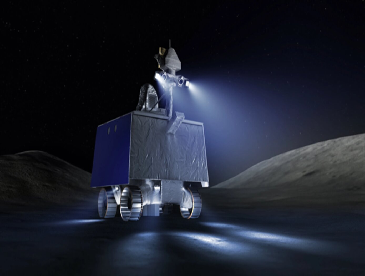
NASA Goddard Space Flight Center has developed a Space Qualified Rover Lidar (SQRLi) system that will improve rover sensing capabilities in a small, lightweight package. The new SQRLi package is developed to survive the hazardous space environment and provide valuable image data during planetary and lunar rover exploration.
The Technology
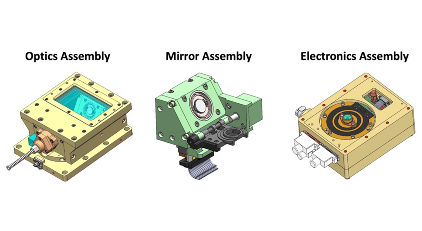
The SQRLi system is made up of three major components including the laser assembly, the mirror assembly, and the electronics and data processing equipment (electronics assembly) as shown in the figure below. The three main systems work together to send and receive the lidar signal then translate it into a 3D image for navigation and imaging purposes.
The rover sensing instrument makes use of a unique fiber optic laser assembly with high, adjustable output that increases the dynamic range (i.e., contrast) of the lidar system. The commercially available mirror setup used in the SQRLi is small, reliable, and has a wide aperture that improves the field-of-view of the lidar while maintaining a small instrument footprint. Lastly, the data processing is done by an in-house designed processor capable of translating the light signal into a high-resolution (sub-millimeter) 3D map. These components of the SQRLi enable successful hazard detection and navigation in visibility-impaired environments.
The SQRLi is applicable to planetary and lunar exploration by unmanned or crewed vehicles and may be adapted for in-space servicing, assembly, and manufacturing purposes. Beyond NASA missions, the new 3D lidar may be used for vehicular navigation in the automotive, defense, or commercial space sectors. The SQRLi is available for patent licensing.


Benefits
- Works in poor lighting conditions: the lidar navigation system can operate in both low ambient light and direct sunlight conditions.
- Highly robust: the SQRLi system is designed to survive harsh environments for planetary exploration.
- Lightweight with a smaller footprint: the SQRLi system is smaller and lighter than other 3D lidar systems usable for rovers.
- Wide field-of-view: the new 3D lidar meets the increased field-of-view needs of next generation rovers.
- Longer range: the SQRLi has an increased range compared to in-use rover navigation sensors.
Applications
- Aerospace: enhanced navigation and imaging for planetary and lunar exploration as well as in-space servicing, assembly, and manufacturing.
- Automotive and defense: improved autonomous vehicular navigation
Technology Details
Optics
GSC-TOPS-352
GSC-19041-1
|
Tags:
|
Similar Results

3D Lidar for Autonomous Landing Site Selection
Aerial planetary exploration spacecraft require lightweight, compact, and low power sensing systems to enable successful landing operations. The Ocellus 3D lidar meets those criteria as well as being able to withstand harsh planetary environments. Further, the new tool is based on space-qualified components and lidar technology previously developed at NASA Goddard (i.e., the Kodiak 3D lidar) as shown in the figure below.
The Ocellus 3D lidar quickly scans a near infrared laser across a planetary surface, receives that signal, and translates it into a 3D point cloud. Using a laser source, fast scanning MEMS (micro-electromechanical system)-based mirrors, and NASA-developed processing electronics, the 3D point clouds are created and converted into elevations and images onboard the craft. At ~2 km altitudes, Ocellus acts as an altimeter and at altitudes below 200 m the tool produces images and terrain maps. The produced high resolution (centimeter-scale) elevations are used by the spacecraft to assess safe landing sites.
The Ocellus 3D lidar is applicable to planetary and lunar exploration by unmanned or crewed aerial vehicles and may be adapted for assisting in-space servicing, assembly, and manufacturing operations. Beyond exploratory space missions, the new compact 3D lidar may be used for aerial navigation in the defense or commercial space sectors. The Ocellus 3D lidar is available for patent licensing.

eVTOL UAS with Lunar Lander Trajectory
This NASA-developed eVTOL UAS is a purpose-built, electric, reusable aircraft with rotor/propeller thrust only, designed to fly trajectories with high similarity to those flown by lunar landers. The vehicle has the unique capability to transition into wing borne flight to simulate the cross-range, horizontal approaches of lunar landers. During transition to wing borne flight, the initial transition favors a traditional airplane configuration with the propellers in the front and smaller surfaces in the rear, allowing the vehicle to reach high speeds. However, after achieving wing borne flight, the vehicle can transition to wing borne flight in the opposite (canard) direction. During this mode of operation, the vehicle is controllable, and the propellers can be powered or unpowered.
This NASA invention also has the capability to decelerate rapidly during the descent phase (also to simulate lunar lander trajectories). Such rapid deceleration will be required to reduce vehicle velocity in order to turn propellers back on without stalling the blades or catching the propeller vortex. The UAS also has the option of using variable pitch blades which can contribute to the overall controllability of the aircraft and reduce the likelihood of stalling the blades during the deceleration phase.
In addition to testing EDL sensors and precision landing payloads, NASA’s innovative eVTOL UAS could be used in applications where fast, precise, and stealthy delivery of payloads to specific ground locations is required, including military applications. This concept of operations could entail deploying the UAS from a larger aircraft.

Adaptive Camera Assembly
NASA’s adaptive camera assembly possesses a variety of unique and novel features. These features can be divided into two main categories: (1) those that improve “human factors” (e.g., the ability for target users with limited hand, finger, and body mobility to operate the device), and (2) those that enable the camera to survive harsh environments such as that of the moon. Some key features are described below. Please see the design image on this page for more information.
NASA’s adaptive camera assembly features an L-shaped handle that the Nikon Z9 camera mounts to via a quick connect T-slot, enabling tool-less install and removal. The handle contains a large tactile two-stage button for controlling the camera’s autofocus functionality as well as the shutter. The size and shape of the handle, as well as the location of the buttons, are optimized for use with a gloved hand (e.g., pressurized spacesuit gloves, large gloves for thermal protection, etc.). In addition, the assembly secures the rear LCD screen at an optimal angle for viewing when the camera is held at chest height. It also includes a button for cutting power – allowing for a hard power reset in the event of a radiation event. Two large button plungers are present, which can be used to press the picture review and "F4" buttons of the Nikon Z9 through an integrated blanket system that provides protection from dust and thermal environments.
Overall, NASA’s adaptive camera assembly provides a system to render the Nikon Z9 camera (a) easy to use by individuals with limited mobility and finger dexterity / strength, and (b) resilient in extreme environments.

Goddard's Reconfigurable Laser Ranger (GRLR)
NASA Goddard Space Flight Center has developed a low cost, modular, and flexible space flight laser range finder consisting of optics, electronics, and interfaces for satellite servicing missions (i.e. Restore-L) using customized optics. Built upon previous NASA technologies, the system also consists of a high dynamic range receiver and adjustable laser for a wide range of measurements (i.e. multiples of km to sub-meter).

Low Weight Flight Controller Design
Increasing demand for smaller UAVs (e.g., sometimes with wingspans on the order of six inches and weighing less than one pound) generated a need for much smaller flight and sensing equipment. NASA Langley's new sensing and flight control system for small UAVs includes both an active flight control board and an avionics sensor board. Together, these compare the status of the UAVs position, heading, and orientation with the pre-programmed data to determine and apply the flight control inputs needed to maintain the desired course.
To satisfy the small form-factor system requirements, micro-electro-mechanical systems (MEMS) are used to realize the various flight control sensing devices. MEMS-based devices are commercially available single-chip devices that lend themselves to easy integration onto a circuit board. The system uses less energy than current systems, allowing solar panels planted on the vehicle to generate the systems power. While the lightweight technology was designed for smaller UAVs, the sensors could be distributed throughout larger UAVs, depending on the application.


